The Gravity Point of Germany
THE Gravity Point IS NOT EQUAL TO THE Midpoint
The center of gravity and the midpont differ in the definition, in the calculation and in the calculation results:
- Definition:
-
- The center of gravity is the equilibrium point of a surface, i.e. the point at which the surface can be balanced.
- The midpoint is the point that is in the middle, i.e. the most central, in relation to all other points in the area.
- Calculation:
-
- The gravity point is calculated by, for example, dividing the area into many squares of equal size and then forming the arithmetric mean from the X and Y coordinates of the square centers.
- From our POV, the midpoint is calculated using the squaring method. Accordingly, the area is divided into many squares of equal size. The square with the smallest distance sum in relation to all other squares is then determined to be the midpoint.
- Calculation Results:
-
- Both in triangles and in all other indeterminate surfaces, the position of the gravity point differs significantly from the midpoint. Exceptions are certain areas such as circles, squares or rectangles
The new Gravity Point of Germany
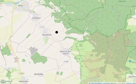
Currently, there are four centroids in Germany. As part of this work, another centroid was calculated. By dividing Germany based on 68,000 border coordinates into 78,000 squares with a side length of 2.13 km and then calculating the arithmetic mean of the centroids of these squares, the gravity point of Germany was determined to be 500 meters east of Bischofroda and north of Berka.
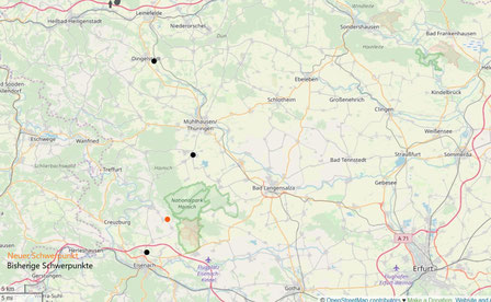
In the underlying work, it was confirmed that all gravity point calculations for triangles and other undefined areas were error-free. Therefore, it is assumed that, as with the midpoint, the most accurate gravity point of Germany to date has been calculated on the 2D plane without the sea. The calculations of the existing centroids are explained in more detail below. There is scant information available on the internet about previous centroid calculations. A more detailed insight was only made possible through the website www.mittelpunkt-deutschlands.de (as of 2021):
- Accordingly, the gravity point at Krebeck was calculated around 1998 using a three-dimensional model of Germany. Since the center of gravity is based on a 2D map of Germany due to the squaring, the centers of gravity differ (50 km north of Bischofroda).
- For the gravity point at Silberhausen, a 1.1 * 1.5 meter map of Germany was also cut out around 1998. Then a plumb line was dropped over several pendulum alignments. How accurate this attempt ultimately was cannot be said, as the 12 mile zone was taken into account on the map. This shifts the gravity point strongly towards the north (25 km north of Bischofroda).
- Niederdorla was not only determined by the enclosing rectangle, but also by balancing a 0.3 * 0.21 meter cut-out map of Germany. No information was given about the inclusion of the sea. In fact, the same calculator that determined Niederdorla as the midpoint in 1990 has balanced this map of Germany so that Niederdorla comes out as the gravity point again ;) . Where 1 cm on the map corresponds to 30 km in reality!
- The gravity point at Landsteit was calculated by digitizing a map of Germany around 1998. This calculation is remarkably close to our calculated gravity point. Here too, the map was divided into 90,000 pixels, integrated into a coordinate system and then all pixels were counterbalanced. Which probably means something like forming the arithmetric mean of the pixels. Nevertheless, this gravity point on Bischofroda also deviates by 7km.
© OpenStreetMap-Contributors


